Thursday, 13 June 2013

Wild about new camera

Brief excursion into camera geekery. I've had very good mileage out of my old compact camera (an extremely inexpensive General Imaging Z1300 from Argos): you really can't complain when you get pictures like this and this. But I've always been aware of its poor low-light performance, slightly cranky focus lock, and limited (3x) optical zoom. I decided it was time for an upgrade, and after a browse of the Argos catalogue, went for a Canon Ixus 500 HS compact.

I won't go into vast detail, except to say that it gives very crisp and (to my eye) accurately coloured images; the focus and motion compensation are superb (I was able to get good distance shots from the pitching Isle of Wight FastCat ferry); the zoom is effortless, and in full auto mode the camera switches seamlessly to whatever mode is needed (e.g. close-up macro or low-light); and the zoom (12x optical, up to 21x digital) is good enough to get very decent shots of creatures that don't like you getting close. And all this from a compact only around 2cm x 5cm x 9cm, £79.99 from Argos. It doesn't get the highest ratings from online camera review sites - it tends to get 4/5 - mostly, I think, because some users find it a bit fiddly, and one slight downside is that it needs a dedicated battery, not AAs. But I'm extremely pleased with it. A few samples from last weekend:


- Ray

Wednesday, 12 June 2013

Tennyson Trail


View Larger Map

Following on from Calbourne - WH Long: there being no public transport nearby, we decided to walk back to Newport along the Tennyson Trail.  It looked straightforward: starting at Winkle Street (probably one of the most picturesque village scenes on the Island), head south along Lynch Lane toward Brighstone, then cut south-east through Brighstone Forest to meet the Trail near the summit of Brighstone Down, the highest point in the central Island.

Winkle Street, Calbourne
Lodge with Westover behind
Brighstone road
In Brighstone Forest
Brighstone Forest - 'cathedral in the woods' (note figure for scale)
The trouble was, we got lost in the forest. Not "lost" in the full sense of the word: sun direction and terrain made it clear where we were in general terms. But there was a criss-cross of quad biking trails that tended to lead nowhere; and near the summit, where the undergrowth thickened, it took us nearly an hour - an increasingly irritated one - to find a path that led to the actual Tennyson Trail. It was nevertheless a beautiful place: the first time I've ever encountered a forest fitting the rather over-used description of "cathedral-like". We eventually found a distinctive curve in a track that matched the map, and got out on to the down top and the path back to Carisbrooke.

North-east view to Portsmouth
North view across Parkhurst Forest
View south-east
View south-east
View to Newport (left) and Carisbrooke Castle
Carisbrooke Castle
Egret in ford, Carisbrooke
It was about 6.5 miles, with more than one stiff climb (during my attempts to find the track), and quite warm; I was tempted to paddle in the egret's pond.

- Ray

Tuesday, 11 June 2013

The Devil's Chimney and The Chink


View Larger Map

On Sunday we revisited the Bonchurch area, and started with the descent into the East End landslip.

For those who haven't seen previous posts on this topic, the topographical situation here - southern Isle of Wight - is that harder Cretaceous strata lie over softer ones, giving a landslip terrain capped by a sheer escarpment of chalk crags, some 7 miles long. At a handful of locations, paths descend from the top of this escarpment through deep clefts in the rock (probably natural joints enlarged), and this visit took in two of them, in the section called the East End landslip, whose terrain dates from slips in 1800 and 1818.

The Southern Vectis No. 3 bus (Newport via Ventnor to Ryde) stops at a car park on Leeson Road, on the slope of Nansen Hill, and it's a short walk to the Smugglers Haven cafe either through lightly wooded parkland or the walled scenic path runs along the edge of the clifftop. Hereabouts there are two stiff descents by steps down rock clefts into the landslip and coastal path below: The Devil's Chimney is to the south, accessed from the corner of the Smuggler's Haven lawn; but there's a second one to the north, almost adjacent to the car park. Its official name appears to be The Chink, though discussions among Isle of Wight aficionados on YouTube have also called it The Son of Devil's Chimney

I checked out The Chink first. This being a bit of a geeky side-excursion, Clare declined on this one. It's a steep but short descent, with a handy seat at the foot of the first steps, giving a view up impressive ash tree roots. Click any image to enlarge.


And on to The Devil's Chimney proper. This is a considerably more spectacular affair, very deep, dark and narrow: I need to take off my rucksack to get around the final bend at the foot.


Probably the only shot to convey just how dark it is


This brings us to the point I reached by ascending from the coastal path a year ago - see The Landslip - Bonchurch to Shanklin. I didn't realise at the time how near I got to The Devil's Chimney; its narrow lower end is invisible from the path until you're very close.

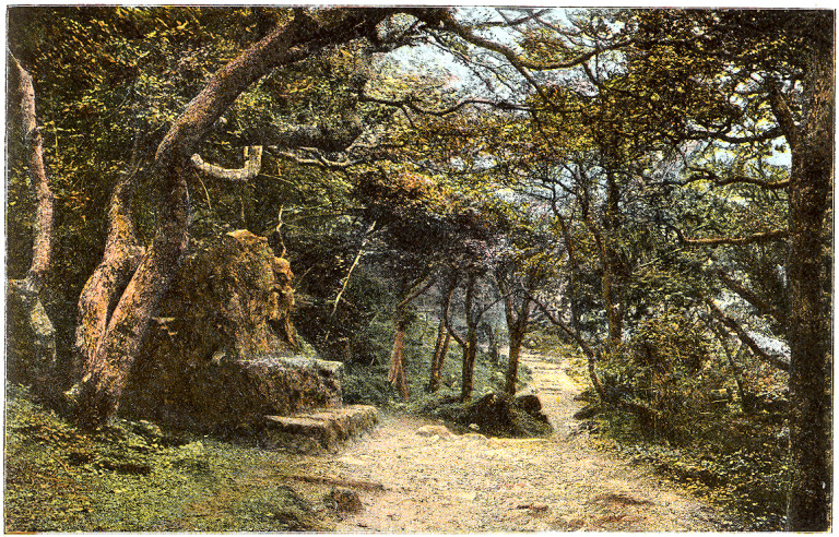
This also completes the trio of publicly accessible rock staircases cutting through the Undercliff crags: The Devil's Chimney; The Chink; and The Chimney in Upper Bonchurch. I suspect these names are surprisingly recent: despite the Isle of Wight County Archaeology and Historic Environment Service's Historic Environment Action Plan: The Undercliff referring to the location as ...
Developed in Victorian times as a picturesque woodland walk, complete with the natural horrors of ‘The Devil’s Chimney’ and ‘The Chink'  as well as the romantic ‘Wishing Stone’.
... I can't find any references to these names going back more than a few decades. Neither the Devil's Chimney nor The Chink feature on the 1908 Ordnance Survey map, but first appear, unnamed, on the 1947. The Devil's Chimney isn't named on OS maps until the 1970s. Nor have I been able to find any old images or old accounts of either (though there are plenty of postcards of the "Stone Seat" in the landslip below). It's a puzzle; do any readers know any more about the history?

Bonchurch. Ventnor in the Distance - from The History and Topography of the Isle of Wight (1864)
Slightly above the centre of the picture, you can just about see Pulpit Rock with its summit cross.
At least one other rock staircase certainly did exist, as I quoted previously from Edmund Venables's 1867 A guide to the Undercliff of the Isle of Wight, Shanklin and Blackgang ...
Passing the gate of Cliffden (Gr. Hibbert, Esq.) one of the loveliest of the many lovely spots in this place where all is beautiful, and the Rectory, we reach the Upper Terrace, and the Hotel ('Ribbands'), which has acquired a well-deserved reputation as one of the best and most comfortable in England, and offers an admirable winter retreat to such as are indisposed to incur the trouble of housekeeping. The grounds at the back command some fine views, and the heights may be reached from them by a rough rock staircase.
...
Several of the houses on the Upper Terrace enjoy the same privilege with the Hotel of scaling the cliffs by one of the rifts that seam its face. There is also a public path or "chimney" at the back of Woodbine Cottage, but so steep and so badly kept as to deter all but expert clamberers.
... but the current state is unknown.

See Undermount for our continuation of the afternoon's walk.

Update: 7th January 2015
I was interested to see that there's a detailed description of the Devil's Chimney as a location in Ali Sparkes' children's SF thriller Unleashed: Mind Over Matter (Oxford University Press, 2013). See the Google Books preview.

- Ray

Monday, 10 June 2013

Calbourne - WH Long

Finally, on Saturday June 8th, we got to Calbourne - the core location, fictionalised as "Malbourne", of Maxwell Gray's The Silence of Dean Maitland.

It wasn't easy. This is a village in the core of the 'West Wight' that, for a very touristy island, is still surprisingly inaccessible if you don't drive. We could have walked the couple of miles from the nearest bus route, as we did in March (see To see Swainston), but my brother-in-law Steve kindly gave us a lift out to Calbourne, and we took the eastern third of the Tennyson Trail back to Newport (of which more later).

One of the first cool things about the visit was seeing this plaque on Grants Cottage commemorating William Henry Long:

This is not the American mycologist of the same name, nor even the Sundance Kid, but the Calbourne-born writer I briefly mentioned in the post about the Maxwell Gray novel Ribstone Pippins. He's an interesting chap who got the break to rise from illegitimate birth and majorly poor roots to become a writer, bookseller, and member of the English Dialect Society.

There's a detailed account of him here - About W. H. Long - at the website of the Isle of Wight folk group The Dollymopps, particularly commemorating his contribution to the folk tradition in recording the lyrics of Isle of Wight folk songs. Here are his books online:
  • A Dictionary of the Isle of Wight Dialect, and of provincialisms used in the Island, with illustrative anecdotes and tales; to which is appended The Christmas Boys' Play, An Isle of Wight "Hooam Harvest" and songs sung by the peasantry, forming a treasury of insular manners and customs of fifty years ago (William Henry Long, pub. Reeves, 1886, Internet Archive ID adictionaryisle00longgoog).
  • The Oglander memoirs: extracts from the mss. of Sir J. Oglander, kt. (pub. Reeves & Turner, 1888, Internet Archive ID oglandermemoirse00oglaiala)
  • Memoirs of Emma, Lady Hamilton: With Anecdotes of Her Friends and Contemporaries (pub. Gibbings, 1891, Internet Archive ID memoirsemmalady00longgoog)
  • Medals of the British Navy and how They Were Won (pub. Norie & Wilson, 1895, Internet Archive ID medalsbritishna00longgoog)
  • Naval Yarns (pub. Gibbings, 1899, Internet Archive ID navalyarnslette00longgoog).
There are a couple of points arising. I mentioned a while back - see Ribstone Pippins - that I very strongly suspect Maxwell Gray's Isle of Wight novel Ribstone Pippins to have been written with a copy of A Dictionary of the Isle of Wight Dialect to hand - the spellings and vocabulary choice were so similar. But there's another possible Maxwell Gray connection. William Henry Long was the illegitimate son of William Warne, a chaise driver in the employ of Sir Richard Simeon at nearby Swainston Manor, and Eliza Long, a farmer's daughter. With a  bit of juggling of roles, could this have been the inspiration for the situation in Gray's The Silence of Dean Maitland, when Alma, the daughter of a coachman on the "Swaynestone" estate, gives birth to an illegitimate child?

As I said, more later. It was an extremely nice weekend. Quite apart from going to one of my sisters' 40th birthday party, we got in some good walking, and (on my part) a bit of photography and some major closure on a couple of my Isle of Wight topographical obsessions. I'll blog about these these non-chronologically: some need more background research than others.

- Ray

Tuesday, 4 June 2013

Route 2: Topsham Lock to Powderham

Sunday May 26th was a fine and bright day: Clare and I took the ferry from Topsham across to the west side of the Exe at Topsham Lock, and walked the The Exe Estuary National Cycle Network (NCN) Route 2 path (aka Exe Estuary Trail) to St Clements Church, Powderham, and back - about 6 miles. As far as the Turf Lock, the pedestrian path runs alongside the canal parallel to the river - you can take a detour inland across Exe Marshes via a pleasant short lane. The rest runs along the top of Powderham Bank, the embankment separating the river from the adjacent pastureland.

Topsham, from the ferry

Exeter Canal, and Turf Lock Cottage

Exminster Marshes

drainage ditch by unnamed lane on Exminster Marshes

unnamed lane

path along Powderham Bank

Powderham Church from Powderham Bank

somewhat hazy view across the Exe to Lympstone


Powderham Bank

Cygnets on Exeter Canal near Turf Locks

Boats moored on Exeter Canal near Turf Locks

 Brief critique: the section between Topsham and the Turf Lock pub is a very enjoyable walk: the canalside pedestrian path and metalled cycle track are separate. We weren't so keen on the section between the Turf Lock and Powderham, since the route is currently a narrow shared path along the top of the sea-wall; as a walker, you need to keep an eye open for cyclists approaching from behind, and we found them a lot of them unprepared to slow down or give audible warning. There's a plan for a wider track - see the October 2008 Design and Access Statement - but it's unknown when this'll happen.

- Ray